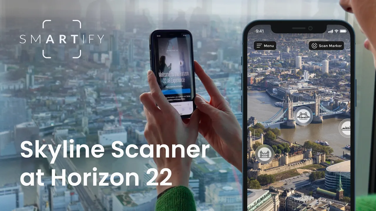
How Smartify’s AR skyline scanner identifies any landmark (no matter the weather!)
Transforming distant landmarks into meaningful stories through web-based augmented reality experiences.

Martin Jefferies
Head of Marketing and CRM
2 min read
•

Panoramic views are unforgettable. But whether it’s standing atop a viewing platform, exploring a historic city, or visiting a landmark with long sightlines, visitors often ask the same question: what exactly am I looking at?
Smartify’s AR skyline scanning feature is designed to answer that question, transforming distant landmarks into meaningful stories through augmented reality.
With Smartify’s AR skyline scanning technology, visitors understand what they’re seeing. In turn, they stay longer, explore deeper and remember more than just the view.
From orientation to interpretation
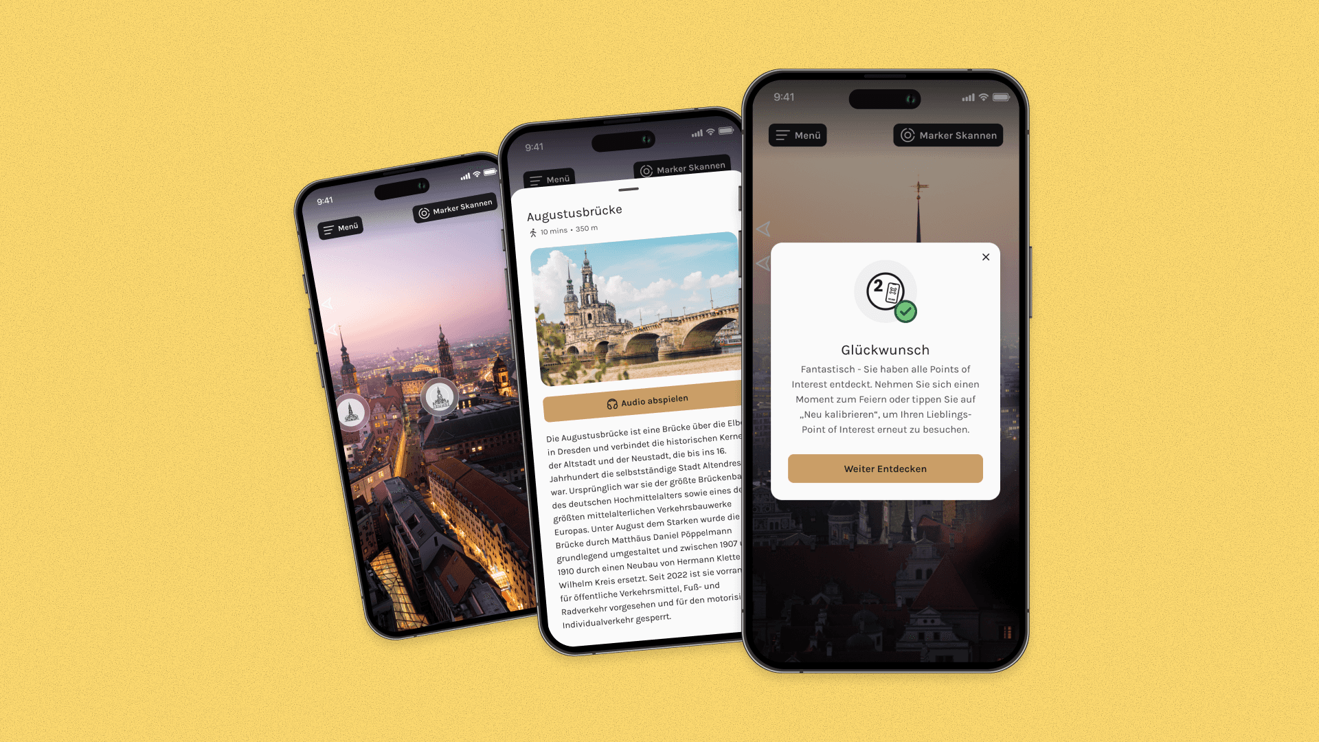
Using a visitor’s smartphone, Smartify’s skyline scanner identifies landmarks in real time by combining geolocation, compass technology and AR overlays.
Visitors point their phone at the skyline to see buildings, monuments and places labelled on screen, with each POI linking directly to rich content.
Every identified landmark can connect to:
audio guides and expert commentary
images, archival material and video
curated stories, timelines and themed trails
It means the skyline is no longer just a view, but an open-air exhibition.
Designed for real-world conditions
Unlike many AR experiences, Smartify’s skyline scanner is built for real environments. It works:
in all weather - clear skies, rain, fog or full cloud cover
day or night
across dense urban landscapes or wide open vistas
Because it runs in the browser, there are no downloads required. Visitors can access the experience on their own devices in an instant, making it ideal for busy, high-footfall attractions.
A flexible tool for many types of attractions
While skyline scanning is a natural fit for observation decks and viewing platforms, its applications extend much further. The feature is well suited to:
city viewpoints and towers
heritage sites with expansive surroundings
outdoor museums and sculpture parks
waterfronts and historic landscapes
It offers a way to interpret places that can’t be labelled physically, whether due to distance, scale, conservation concerns, or building restrictions.
The feature is already in use at places like Horizon 22 in London, UK, and Dresden Frauenkirche in Germany.
Enhancing the visitor journey
For visitors, skyline scanning removes friction. It answers common questions and supports self-guided exploration at each person’s own pace. For international tourists in particular, it provides instant clarity and even translations.
For venues, the feature integrates with existing Smartify content. It can support premium tour experiences, family trails and educational storytelling, all without additional hardware or complex installation.
With Smartify’s AR skyline scanning technology, visitors understand what they’re seeing. In turn, they stay longer, explore deeper and remember more than just the view.
Learn more about web-based AR experiences from Smartify
More stories

Bodleian Libraries launches new Outdoor Audio Trail with Smartify

Horniman Museum and Gardens launches playful AR trail with Smartify
How visitors discover more about your collection and why it matters

The future of cultural experience: five things we learned at Experience 2031

Connecting visitors to 800 years of history at Grimsthorpe Castle